
As part of its new action plan for sustainable vegetation management, Network Rail is using cutting-edge technology along Britain’s 20,000-mile rail network,
Scientists from the UK Centre for Ecology & Hydrology (UKCEH) have used high-resolution imagery from satellites and aircraft to produce a detailed national map of all the habitats found alongside the rail network, which dates back almost 200 years.
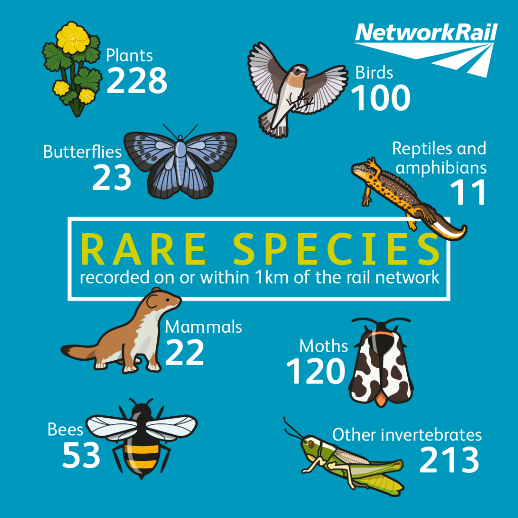
By combining this information with millions of records of species, UKCEH has predicted what animals and plants are likely to be present in these lineside habitats including grasslands, heathlands and woodland. This information will ensure Network Rail workers and contractors are aware of the possible presence of rare species when carrying out vegetation management, plus inform the company’s conservation measures to increase biodiversity. It also provides a baseline for monitoring future trends in biodiversity.
This initiative is part of Network Rail’s new Biodiversity Action Plan – drawn up in collaboration with UKCEH scientists – which is an important step in achieving a sustainably managed lineside. It contains numerous examples of best practice management for biodiversity across the rail network, including alternatives to tree felling, such as crown reduction, pollarding and coppicing of large trees. The plan pledges to not just replace ecologically important vegetation that it has to remove to maintain safety and services, but also carry out habitat creation to increase connectivity between existing habitats.
Since the 1960s, there have been large changes in vegetation associated with the railway, which has resulted in the loss of biodiverse, flower-rich habitats. In its plan, Network Rail has committed to end net loss in biodiversity on its land by 2024 and achieve a net gain by 2035.
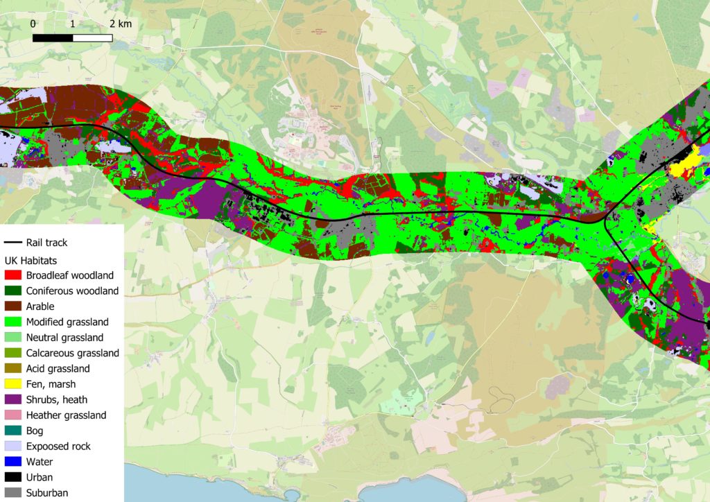
Professor Richard Pywell of UKCEH, which used the latest detailed satellite data and its expertise in land cover mapping to identify lineside habitats, says: “This is an ambitious new plan to use the latest technology to manage habitats more sustainably along Britain’s railways, and it has been a great opportunity to work with Network Rail to improve biodiversity.
“Using high-resolution satellite and aircraft imagery enables us to map habitats across the rail network in a safe, quick and cost-effective way. By analysing the wealth of biological records across the UK, we have been able to identify likely biodiversity ‘hotspots’ and understand more about the role of the railway in connecting wildlife across landscapes. Together, this new information will inform Network Rail’s thinking on how best to maintain and enhance the environment.”
Martin Frobisher, Network Rail’s safety, technical and engineering director, added: “This technology is tremendously exciting. Measuring biodiversity is very complicated and it’s especially tricky for a large organisation such as Network Rail, which manages a vast land estate spread throughout the country. This is a real breakthrough and this technology enables us to measure and monitor the progress we are making.
“We are determined to improve the biodiversity alongside the railway lineside. Our Biodiversity Action Plan sets out a new approach and by working with experts like UKCEH and by using the latest tools and technology we can better manage and conserve a species-rich lineside while continuing to run a safe and reliable railway that benefits our passengers, our neighbours, and our planet.”
